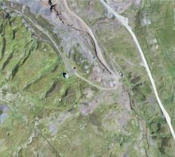
GeoAccess - Plant Health & Invasive Species Mapping
Price: CALL FOR ASSISTANCE
Aerial mapping can quickly and efficiently provide a means to assess the health and condition of a wide range of vegetation types and identify invasive species. The maps are a powerful tool for agronomists, farmers, growers and vegetation management teams to locate areas of concern quickly and allow ground-truthing to determine the problems and remedy the situation in much quicker time and make significant cost-savings.
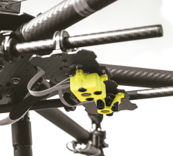
Terabee - Intelligence for Drone Applications
Price: CALL FOR ASSISTANCE
Terabee welcomes collaboration from partners looking for innovation in sensing and intelligence for drone applications! Our technical expertise includes drone-optimized “indoor GPS” for GPS-denied environments, sensor fusion, algorithms, control system development, custom sensor design, sensor industrialization and integration into customer platforms.
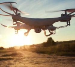
Digital Drone Services - Agricultural Services
Price: CALL FOR ASSISTANCE
Making life easier by performing agricultural surveys to increase yield or quality on crops, or for a number of other applications.