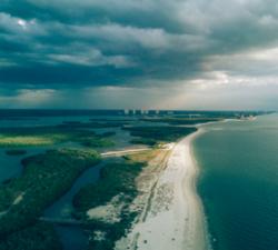
Caelus Drones - Environmental Services
Price: CALL FOR ASSISTANCE
We can use drone technology to monitor and help manage coastlines, monitor rivers, erosion and floodplains, difficult to reach places of interest, help identify potential blockage points as part of flood defence programmes, provide live feed and data as part of emergency services during natural disasters, monitor pollution and more.
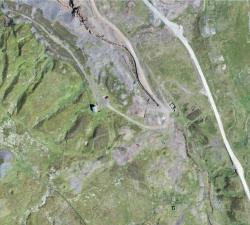
GeoAccess - Plant Health & Invasive Species Mapping
Price: CALL FOR ASSISTANCE
Aerial mapping can quickly and efficiently provide a means to assess the health and condition of a wide range of vegetation types and identify invasive species. The maps are a powerful tool for agronomists, farmers, growers and vegetation management teams to locate areas of concern quickly and allow ground-truthing to determine the problems and remedy the situation in much quicker time and make significant cost-savings.