Editorial Feature
What’s the difference between PPK and RTK drones, and which one is better?
Words By: Drone Major
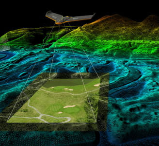
Post-processed kinematic (PPK) and real-time kinematic (RTK) are not new technologies. They’ve been used in terrestrial surveying for years to improve the accuracy of GNSS data. Both methods correct the location of drone mapping data and remove the need for GCPs, bringing absolute accuracy down to cm (sub-inch) range
However, when you factor in obstacles and environmental conditions common to aerial surveying, the difference between a PPK drone and an RTK drone becomes more important to understand. In fact, choosing the best correction method for your surveys will save you time and project costs. But how do you know which is best? The answer can be found in learning about how each method works, including its inherent strengths and drawbacks.
What is an RTK drone (and how does RTK work)?
RTK requires four constant communication lines to correct satellite location data: 1. the line between satellites and drone, 2. the line between satellites and GNSS base station or CORS (supporting VRS via mobile) network, 3. the line between the GNSS base station or CORS/VRS and the drone base station, and 4. the line between drone base station and drone.
It might seem nice to get corrected data during a flight. However, in real conditions, where obstacles can block or interrupt signals and flights might extend beyond a signal’s strength, RTK technology presents weaknesses worth considering. In the best case—where the link between base station and drone stays constant—RTK achieves the same absolute accuracy as PPK. Yet in all cases, PPK reliability is better. Why? The answer is found in how it works.
What is a PPK drone (and how does PPK work)?
PPK requires two constant communication lines to correct satellite location data: 1. The line between satellites and GNSS base station or CORS network, and 2. the line between satellites and drone.
Because you don’t need to maintain a link between the stationary base station and drone base station, and a link between the drone base station and the drone in the case of PPK, this method presents more reliable data correction and easier set-up. If you’ve ever worked with drones, you know that short interruptions in telemetry links happen quite frequently. When they do, the loss of lock lasts longer than just a moment. It takes time to reinitialize. And until it does, you lose correction data for that particular area of your drone survey. So with RTK, you are more likely to end up with significant gaps in your data where accuracy degrades to GPS quality.
RTK vs. PPK overview
Both PPK and RTK technology can correct satellite data down to cm (sub-inch) levels, and both methods depend on an on-board receiver like the (high-end Septentrio WingtraOne PPK) module pictured, but their fundamental differences include reliability and are worth considering.
Because it is more reliable, PPK is often suggested as a back-up for RTK that fails. So why use RTK in the first place?
The following pros and cons offer a clear answer and are aimed to help you decide what’s best for your projects.
RTK Pros
RTK Cons
PPK Pros
PPK Cons
Why we recommend a PPK drone
In the end, RTK may appear to save time since you have corrected data the moment you land, but given the links it depends on to work, it is bound to fail sometimes. PPK offers easier set-up and more robust data collection by removing unstable telemetry links. The time it takes to post process is small compared to the time it would take to re-run flights if RTK data links fail, which they are prone to do.