
Cambridge Sensoriis is a designer of micro-radar sensors for applications that require robust high-resolution measurement in a low-SWaP (Size, Weight, and Power) package. We design the radar antenna, radar signal processing and radio frequency componentry.
Our radars measure range, bearing, elevation, and velocity to objects, detecting potential obstacles and way-points in all operating and weather conditions. This lightweight, highly sensitive, all weather and easy to install Radar technology is suitable for use on all autonomous vehicles including drones, maximising automation, and minimising costs. We have also developed a patented capability, Active Radar Cooperating – or ARC – two or more radars cooperating with each other. This allows our customers to achieve high precision measurement of landing pads (onshore and offshore) for autonomous control; locate a journey endpoint within centimetres, without satellite navigation (GNSS); and provide assured positioning while a drone surveys infrastructure, amongst many other potential applications. ARC-Landing can be used in conjunction with RadarAware, our micro radar, which enables a drone to detect objects in the flight path, supporting the safe operation of drones in and around turbines, high-value assets, or infrastructure as they are surveyed.
ARC-Landing Radar System
Autonomous landing of UAS onto a moving vessel, possibly in GNSS denied environment.
Our ARC-Landing radar system is a vital part of supporting the autonomous landing of an Uncrewed Air System (UAS) onto a vessel. The UAS will have completed a mission, such as ship-to-shore (or port-to-ship) drop, last mile resupply in a military mission, or an offshore windfarm inspection, then the Uncrewed Air Vehicle (UAV) would need to land on the moving vessel, possibly in a GNSS denied environment.
An ARC primary radar, installed onto the UAV, will actively cooperate with ARC secondaries on the moving vessel, enabling relative positioning during the critical approach and landing phases of UAV flight, through our ARC-Landing system. Automation removes the need for highly skilled and scarce offshore drone pilots and hence greatly reduces the costs of offshore windfarm maintenance and ship-to-shore or port-to-ship operations. ARC-Landing also facilitates the automation of a drone landing onto a pad, such as in the case of a vertiport. The micro radar installed onto any drone can locate the drone in 3D relative to the pad for autonomous landing.
Radar for Beyond Visual Line of Sight Flights & Airspace Management
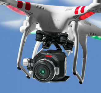
Micro-radar sensor for drone situational awareness
Sensoriis provides both aerial and ground-based radar systems that enhance safety and efficiency, providing accurate situational awareness and helping to accelerate the integration of drone operations into everyday life.
Resilient drone operation over long distances, in changeable weather, requires robust onboard sensing. Our RadarAware micro radar enables a drone to detect objects in the flight path, whether in the air or ground based.
RadarAware RA1000 is a robust, all weather onboard air-to-air radar that detects obstacles and prevents accidents through collision with cables, infrastructure, trees, non-cooperating drones, birds, and light aircraft.
Automated drones flown ‘Beyond Visual Line of Sight’ can gather detailed close-quarter data from power lines or railway catenary lines, assessing for corrosion and other problems in relation to signalling infrastructure, alignment of tracks and switching points.
Current inspections and maintenance work is often carried out from helicopters, or manually flown drones, which is labour intensive and expensive. Our drone radar system significantly reduces survey costs by supporting long flying missions without the oversight of a ground-based pilot and provides safety and peace of mind during such operations.
Additionally, RadarAware RA1000, installed on the ground, allows surveillance and monitoring of the surrounding sky from the landing area of a vertiport for example.
Our systems detect drones approaching the vertiport and reports their locations. They support safe coordination of the approach of drones that we expect, and unanticipated flying objects such as non-cooperating drones, light aircraft, and general aviation. This is airspace management that can be trusted.