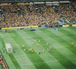
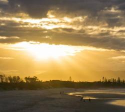
Caelus Drones - Photography & Media
Price: CALL FOR ASSISTANCE
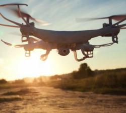
The original application for drone services!
Skeye - Aerial Photography
Price: CALL FOR ASSISTANCE
Skeye BV provides aerial photography throughout the country, both in urban and rural areas. Due to our wide variety of possibilities and materials we can always deliver. We always produce the desired result through the deployment of drones, manned airplanes, helicopters and aerial platforms.
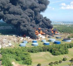
Caelus Drones - Disaster Management
Price: CALL FOR ASSISTANCE
We can mobilise ourselves 24 hours a day often at short notice, so we can assist in the event of any emergencies.
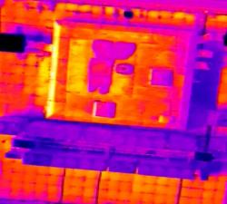
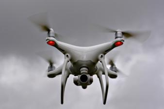
Droneflight - Thermography
Price: CALL FOR ASSISTANCE
Thermal imaging cameras offer a new dimension to aerial and ground-based diagnostic, rescue and surveillance work. Hotspots and temperature differences provide you with accurate and fast insight.
Estate Drone Survey - Aerial Cinematography
Price: CALL FOR ASSISTANCE
Estate Drone Survey specialises in aerial cinematography using the latest unmanned aerial systems (UAS). As a fully licensed operator with permission from the Civil Aviation Authority, we are able to supply our clients with aerial filming and photography unsurpassed by any other provider. In order to operate a UAS commercially, you must be granted a permission for aerial work by the CAA. All of our operators have undertaken and achieved a BNUC-S qualification attained from the European Unmann
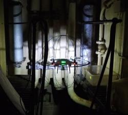
GeoAccess - Interior & Confined Space Aerial Inspections
Price: CALL FOR ASSISTANCE
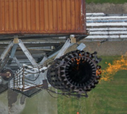
GeoAccess are always ready to embrace new technology and innovative designs, to that end we have recently acquired a collision-resistant cage for our DJI Phantom 4 Pro by DRONECAGE to enable us to safely conduct inspections in locations that are difficult to access, and certain types of confined spaces.
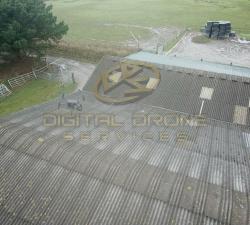
Digital Drone Services - Photogrammetry & Orthomosaics
Price: CALL FOR ASSISTANCE
Photogrammetry & Orthomosaic Services
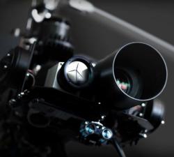
Cloud3D - Aerial Photography & Video
Price: CALL FOR ASSISTANCE
Our carefully selected or designed UAV's (Drones) are capable of being fitted with various camera or imaging systems to take either photographs or video. Using motor driven stabilising gimbals we can shoot perfect images in even the most chalenging of situations.
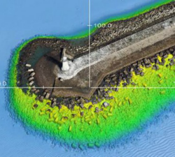
Skeye - Digital Terrain Models
Price: CALL FOR ASSISTANCE
Skeye specializes in making aerial photographs at low altitude with a geometrically calibrated camera. This enables us to obtain all heights, of a landscaped area. At each height (Z) the coordinates (X, Y) are also recorded. This creates a digital terrain model that can be calculated quickly and accurately. The volume of a stockberg can be calculated relative to a base plane or if two measurements take place at different times, a difference calculation can be made.
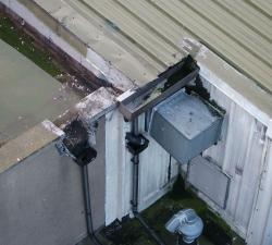
GeoAccess - Aerial Inspections
Price: CALL FOR ASSISTANCE
GeoAccess can offer a stand-alone UAV inspection service and also integrated UAV plus rope-access teams, depending upon the requirements of the inspection. Our flight-crews and rope-access technicians are from similar professional backgrounds, have shared knowledge and experience that allows them to work together seamlessly and efficiently.
Swoop - Get funding with Swoop
Price: CALL FOR ASSISTANCE
The one-stop money shop for your businessSwoop simplifies and speeds-up access to loans, grants and equity funding for businesses.
RINA - Safety & Environmental Management
Price: CALL FOR ASSISTANCE
We have experience in providing safety advice across a spectrum of high-risk technologies and equipment, in the air, land and maritime domains. Our security engineering services include security risk management, information security and cyber-security as well as physical and homeland security system engineering. Managing the dynamic of safety, security, reliability, availability and resilience is crucial to ensuring that the space and defence sector have effective capability.
Digital Drone Services - Event Announcement
Price: CALL FOR ASSISTANCE
Having a big sale, on-site celebrity, or other event?

Evoke Management - Part Time Finance Director Services
Price: CALL FOR ASSISTANCE
Outsourced FD Services Find out how a part time Finance Director will save your business tens of thousands this year whilst ensuring your future growth looks after you, the business owner, for many years to come.

Estate Drone Survey - Anti Drone Solution
Price: CALL FOR ASSISTANCE
Drone technology has evolved at an alarming rate, more than anyone could ever have imagined leaving regulation, laws and drone capability behind. At Drone Resist, we provide a counter solution that is cost-effective and achieves results.
Terabee - Intelligence for Drone Applications
Price: CALL FOR ASSISTANCE
Terabee welcomes collaboration from partners looking for innovation in sensing and intelligence for drone applications! Our technical expertise includes drone-optimized “indoor GPS” for GPS-denied environments, sensor fusion, algorithms, control system development, custom sensor design, sensor industrialization and integration into customer platforms.

CentralFX - Foreign Exchange
Price: CALL FOR ASSISTANCE
Every business is affected by foreign currency in different ways. Whether you are buying or selling currency, how you choose to execute your foreign currency transactions can have a considerable effect on the profitability of your business. It is therefore imperative that you choose a foreign exchange partner who will work together with your business to manage your requirements and protect your bottom line.
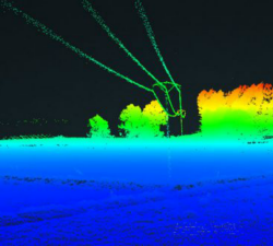
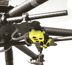
Skeye - UAV LiDAR
Price: CALL FOR ASSISTANCE
Skeye recently added a new sensor for recording geodata in addition to existing sensors such as daylight, near infrared and thermal cameras. The sensor is the YellowScan Surveyor which is capable of making very accurate and dense data points.
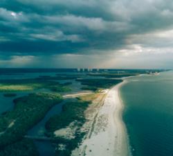
Caelus Drones - Environmental Services
Price: CALL FOR ASSISTANCE
We can use drone technology to monitor and help manage coastlines, monitor rivers, erosion and floodplains, difficult to reach places of interest, help identify potential blockage points as part of flood defence programmes, provide live feed and data as part of emergency services during natural disasters, monitor pollution and more.
Digital Drone Services - Survey & Inspection
Price: CALL FOR ASSISTANCE
Any type of survey carried out from roof inspections to masts and towers.
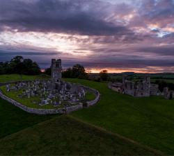
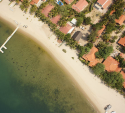
Drone Services Ireland - Aerial Photography
Price: CALL FOR ASSISTANCE
Drone Services Ireland shoot professional aerial photography and video using the latest in drone technology to bring you ultra-high-resolution photos and video. All of our aerial photography images are shot in RAW format allowing us to capture the full dynamic range that the DJI X5S allows. We are also able to change lenses, to allow varying focal lengths enabling us to capture a unique shot for each situation.
Digital Drone Services - Aerial Photography
Price: CALL FOR ASSISTANCE
Like a scene taken from a different angle? This is your solution.
36 Tech Barristers - Legal Services
Price: CALL FOR ASSISTANCE
36 Tech Barristers can provide legal advice and representation on all matters of law, regulation and contracts related to the commercial use and application of drones and drone technologies.We serve corporates and individuals in relation to the commercialisation of their good name, products and services, the protection of their technology, brand and intellectual property and the rights and responsibilities in relation to personal data.
Moonrock Insurance - Drone Insurance
Price: From £31 - £68
We pride ourselves on offering the best drone insurance in the UK that's suited perfectly to professional drone operators seeking superior insurance to operate drones commercially in the UK. Our staff are well informed on both insurance and the drone industry and will always ensure you have the correct policy for your needs.
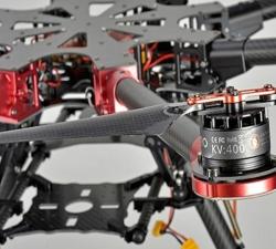
Cloud3D - UAV Bespoke Design
Price: CALL FOR ASSISTANCE
We use our engineering, software and electronic knowledge to design and build UAV's to perform a specific task, carry a payload or meet a desired flight time.
Royds Withy King - Legal advice for the commercial use of drones
Price: CALL FOR ASSISTANCE
Legal advice for the commercial use of drones
Skeye - Volume Computations
Price: CALL FOR ASSISTANCE
Skeye specializes in the accurate measurement of stocks or mountains stored material using unmanned helicopters (drones). These are equipped with a 36Mp digital camera and geometrically calibrated to perform measurements. These measurements are based on the photogrammetric principle whereby terrain heights can be calculated in the overlapping portion of photographs taken from another point of view.
Geo-4D - 3D Ground Modelling
Price: CALL FOR ASSISTANCE
Geo-4D offers full ground modelling capability and expertise combined with data QC and management services. We use the only software available that enables full interaction with all relevant site data, on dedicated work stations, avoiding the use of multiple software packages and awkward file exchange formats.
GeoAccess - Plant Health & Invasive Species Mapping
Price: CALL FOR ASSISTANCE
Aerial mapping can quickly and efficiently provide a means to assess the health and condition of a wide range of vegetation types and identify invasive species. The maps are a powerful tool for agronomists, farmers, growers and vegetation management teams to locate areas of concern quickly and allow ground-truthing to determine the problems and remedy the situation in much quicker time and make significant cost-savings.
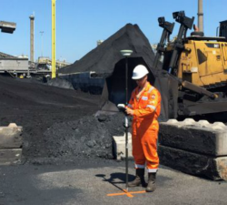
Aero Enterprise - Inspection
Price: CALL FOR ASSISTANCE
All high-resolution image data of the inspected objects are recorded using the self-developed AERO-SensorCopter®, which is specially designed to perform under harsh offshore weather and wind conditions.
Droneflight - Aerial Film & Photography
Price: CALL FOR ASSISTANCE
We have a broad range of skills and equipment that can safely and confidently deliver the amazing aerial photography or video to your project. We can produce final videos for you, work with your production company or provide you with raw footage.
Estate Drone Survey - Anti Drone Solution
Price: CALL FOR ASSISTANCE
Drone technology has evolved at an alarming rate, more than anyone could ever have imagined leaving regulation, laws and drone capability behind. At Drone Resist, we provide a counter solution that is cost-effective and achieves results.
Skeye - Drone Inspections
Price: CALL FOR ASSISTANCE
Skeye's unmanned aircraft (drones) are able to reach those places that are difficult, expensive, dangerous, 'live' or even impossible for manned inspection teams.
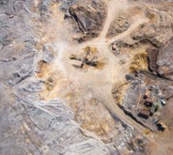
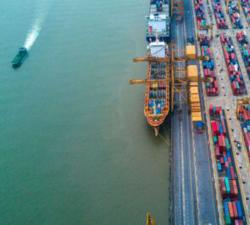
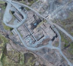
Caelus Drones - Industrial Surveys
Price: CALL FOR ASSISTANCE
We can provide highly accurate data for surveys.
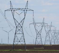
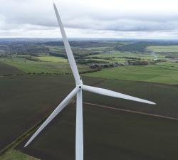
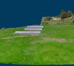
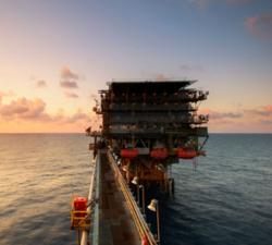
Caelus Drones - Industrial Inspections
Price: CALL FOR ASSISTANCE
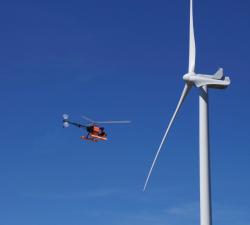
We can inspect renewable energy sources such as wind turbines and solar panels, tunnels, bridges, oil rigs, telecoms, pipelines, pylons, tall buildings and more. The list is endless and only limited by the regulations we must follow.
Digital Drone Services - Agricultural Services
Price: CALL FOR ASSISTANCE
Making life easier by performing agricultural surveys to increase yield or quality on crops, or for a number of other applications.
Estate Drone Survey - Legal Services
Price: CALL FOR ASSISTANCE
At Blakiston’s, our specialist expertise encompasses UAS/UAV legal issues, intellectual property, contracts, privacy, tortious liability and airspace and airworthiness regulation.
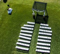
Skeye - Aerial Tours
Price: CALL FOR ASSISTANCE
An impressive Skeye product is the 360 degree panoramic tour. Recorded from the sky in combination with additional footage on the ground. This looks like Google Streetview but from the sky.
Caelus Drones - Bespoke Services
Price: CALL FOR ASSISTANCE
Do you have a requirement that you believe would benefit from drone technology? If you are unsure if we can help, please call us to have a chat. We will be completely upfront and explain any potential issues with your project if there are any!
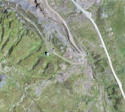
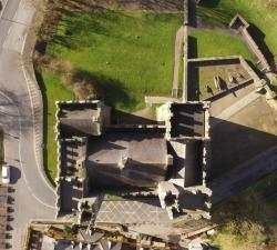
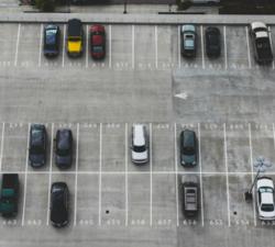
Skeye - Aerial Surveying & Mapping
Price: CALL FOR ASSISTANCE
Skeye uses drones (small unmanned helicopters and aircraft) to make aerial photographs at low altitude. With these pictures we make 3D digital height and terrain models and orthophoto mosaics (underlayers images).
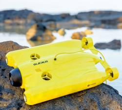
GeoAccess - Underwater Inspections
Price: CALL FOR ASSISTANCE
Once the preserve of traditional remotely operated vehicles (ROVs), GeoAccess can now offer underwater inspections, photography and video with our submersible drone, the Chasing-Innovation Gladius V2. We strongly believe that we can offer a cost-effective, comprehensive underwater inspection service, providing high-resolution photography and 4K video, without compromising quality and safety, and without having to rely on larger, cumbersome, less manoeuvrable ROVs.
Skeye - Orthophoto Mosaics
Price: CALL FOR ASSISTANCE
Skeye uses unmanned helicopters and aircraft for low-altitude aerial photographs. This enables us to work quickly, flexibly and cost-effective. This low altitude delivers unique and sharp images on which all the details can be seen.
UAS FLIGHT OPS - Photography and Filming
Price: CALL FOR ASSISTANCE
As one of the first commercial UK drone companies we started small and through our safe and professional approach have earned a reputation for delivering quality results within budget.
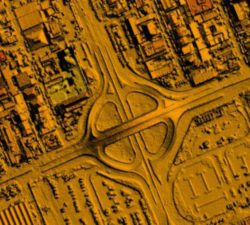
GeoAccess - Mapping & 3D Modelling
Price: CALL FOR ASSISTANCE
Our Principal Pilot has successfully completed a dedicated drone mapping course given by an ex-Royal Air Force aerial imaging and spatial analyst with 25 years of knowledge and experience in this highly specialist field. We can offer 2D mapping (ortho-mosaics) at various levels of resolution, with high relative accuracy and export the finished products in a variety of formats, depending upon client requirements. 3D models can be viewed in Sketch Fab and embedded directly in a webpage.
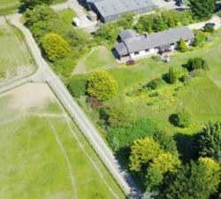
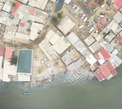
Drone Services Ireland - Residential Inspection
Price: CALL FOR ASSISTANCE
Drones have many uses for residential and commercial customers, from high roof inspections to guttering, a high-resolution map of the roof can be created, that can be zoomed and examined later. Current Aerial imaging cameras are capable of producing very high-resolution images which can be stitched together to create a map of an area or object.
The Drone Guys - Photography and Video Filming
Price: CALL FOR ASSISTANCE
Being able to fly a drone doesn't make you a drone photographer .. Luckily The drone Guys are a group of highly skilled and professional photographers. Along with being skilled drone pilots they know exactly how to get that professional shot that is required by our clients. Using the most up to date equipment and post processing techniques to get you exactly what you need from the air.
Caelus Drones - Surveillance
Price: CALL FOR ASSISTANCE
If you have a requirement to monitor and track high-value assets, please get in touch.
Mirragin RAS Consulting - RPAS Consultant
Price: CALL FOR ASSISTANCE
Professional RPAS Technology Unmanned Systems Consultant. A recent PwC report estimated that the global market for applications of Commercial Remotely Piloted Aircraft Systems (RPAS) will reach $127 Billion by 2020, including industries such as:.
Droneflight - Inspection Services
Price: CALL FOR ASSISTANCE
We have the experience and equipment needed to operate in complex industrial environments which often have unseen hazards. Our capabilities in 3D and Thermal Imaging will deliver new insights into your inspection needs. From regular inspections to details analysis in partnership with your team we can help.
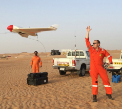
Aero Enterprise - Engineering
Price: CALL FOR ASSISTANCE
Aero Enterprise supports the customer during UAV projects like development of special UAVs, certificates of airworthiness and documentation as well as external payloads.